
Groups look to protect the land

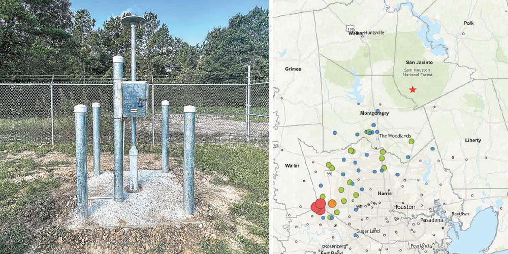 A monitoring station will track any land subsidence in southern San Jacinto County. Area of the district experiencing sinkholes and other effects of land subsidence. Courtesy Photos
Special to the News-Times
The Lower Trinity Groundwater Conservation District and Mercy Water Supply Corp. of San Jacinto County have teamed up to keep an eye on subsidence in the southern part of San Jacinto County.
Randy Baker, president of the Lower Trinity Groundwater Conservation District and operations manager of Mercy Water Supply Corp., said that even though county does not show signs of subsidence, having a system in place to monitor and avoid groundwater subsidence made sense.
“The groundwater district uses the data to understand land surface deformation trends and monitor subsidence to know if any changes do happen over the next few years of aquifer use in the area as we continue to grow in population,” he said.
Land subsidence (such as sinkholes) is the gradual lowering of surface elevation caused by compaction of fine-grained aquifer sediments (silts and clays) below the land surface due to groundwater well withdrawals.
Mercy Water Supply Corp. supplied the land and power for the groundwater district to have a monitoring system installed that uses GPS to detect any movement of the ground either up or down or sideways. The Harris-Galveston Subsidence District donated all the computer equipment.
The GPS monitoring station consists of a deep pipe that holds an antenna that collects satellite signals and an enclosure box that holds a receiver which stores the satellite data and powers the equipment.
The station collects data every 30 seconds, which is averaged over 24 hours every day of the year. The Groundwater District collects the raw GPS data and sends the data to the Harris-Galveston Subsidence District and the University of Houston that currently monitors more than 220 stations in the Gulf Coast Aquifer area to collect and process it to produce the rate of change in the horizontal and vertical directions. Then reports their findings to all the areas water planning groups.
Removing water from fine-grained aquifer sediments compresses the aquifer leaving less pore space available to store water, resulting in the sinking or settling of the land-surface. Most compaction that occurs because of groundwater withdrawal is irreversible; even if groundwater levels rise, compacted sediments and the associated land-surface lowering would remain.
Consequences of land subsidence already exist south of San Jacinto in Montgomery County, The Woodlands and the Houston-Galveston area. Symptoms of subsidence include reduced ability to store water in an aquifer, partially or completely submerged land, collapsed water well casings, disrupted collector drains and irrigation ditches, altered flows of creeks and bayous which may increase the frequency and severity of flooding, and damaged roadways, bridges, building foundations and other infrastructure.
You are a guest
or post as a guest
Be the first to comment.
